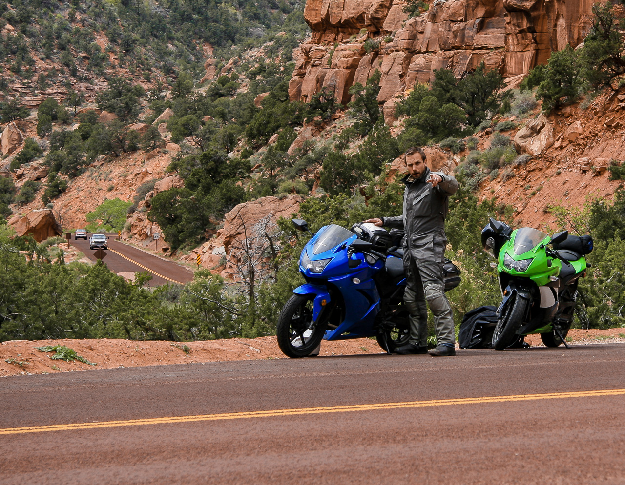
We slept well, despite the Vegas lights strobing through thin window curtains all night. Before making a parting run of The Strip, I inspected the chain on Brian’s bike. At a glance, it looked in passable shape, seemingly still taut after the previous morning’s adjustment. Good enough for me.
April 11, 2013
To get to Utah, we’d first drowsily roll miles of Interstate 15 through eastern Nevada and northwestern Arizona. Think that’s a helluva roster for a highway? Add California, Idaho and Montana to the list of states covered by 15. To go from Mexico to Canada, Interstate 15 is all I’d need, plus a requisite overdose of caffeine to keep awake.
The Nevada miles are forgettable, but 15 gets interesting at the east border. The highway aims straight for what appears to be a solid mountain range, and for an hour I dreaded the elevation. I wanted lazy miles, and mountain passes are rarely lazy. Or warm.
But what looked a solid wall of mountain, at the last mile in a dramatic reveal, exposed a narrow river gorge behind the veil of perspective. The highway knew all along. Clever girl.
The Virgin River Gorge spared us elevation, and ushered in the beautiful southwest. Rivers carve wonderful lines for roads. The tall mountains I didn’t want to ascend were instead on either side of Brian and me, pale walls of water-worn rock zig-zagging us through Arizona and finally into Utah.
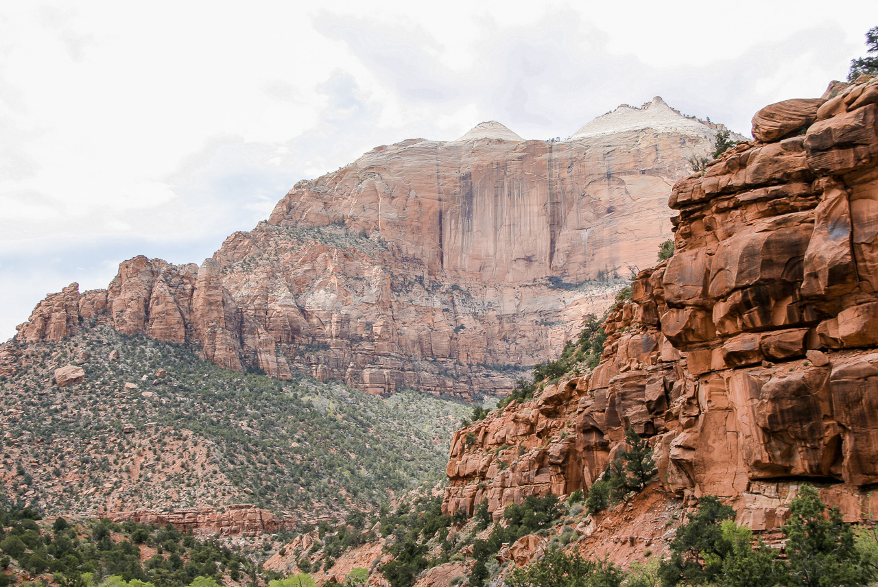
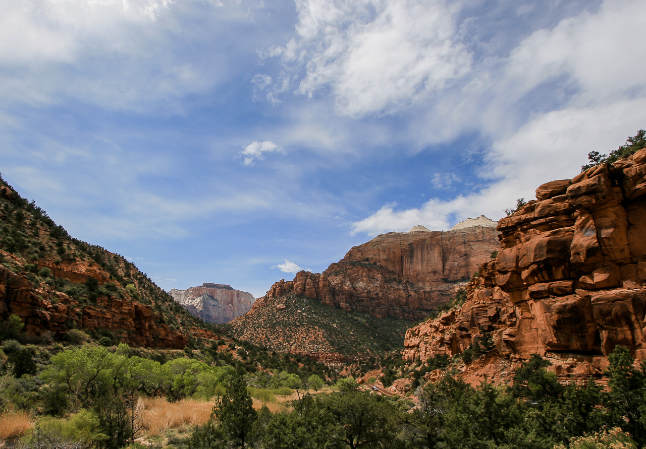
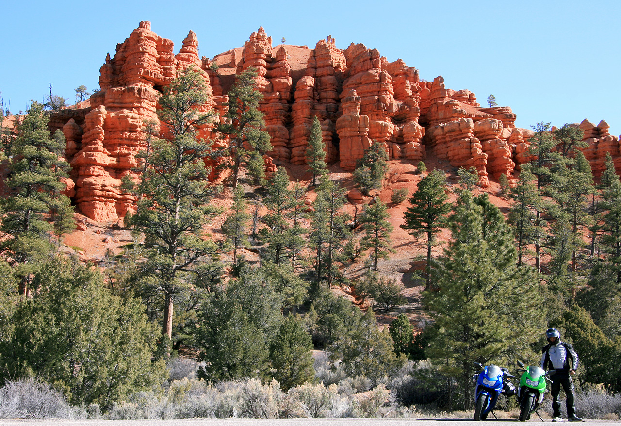
All of Utah is, evidently, fantastically photogenic. Especially Zion. I had no expectations for Zion, it was on the map and I figured why not, but it’s now one of my favorite places on Earth.
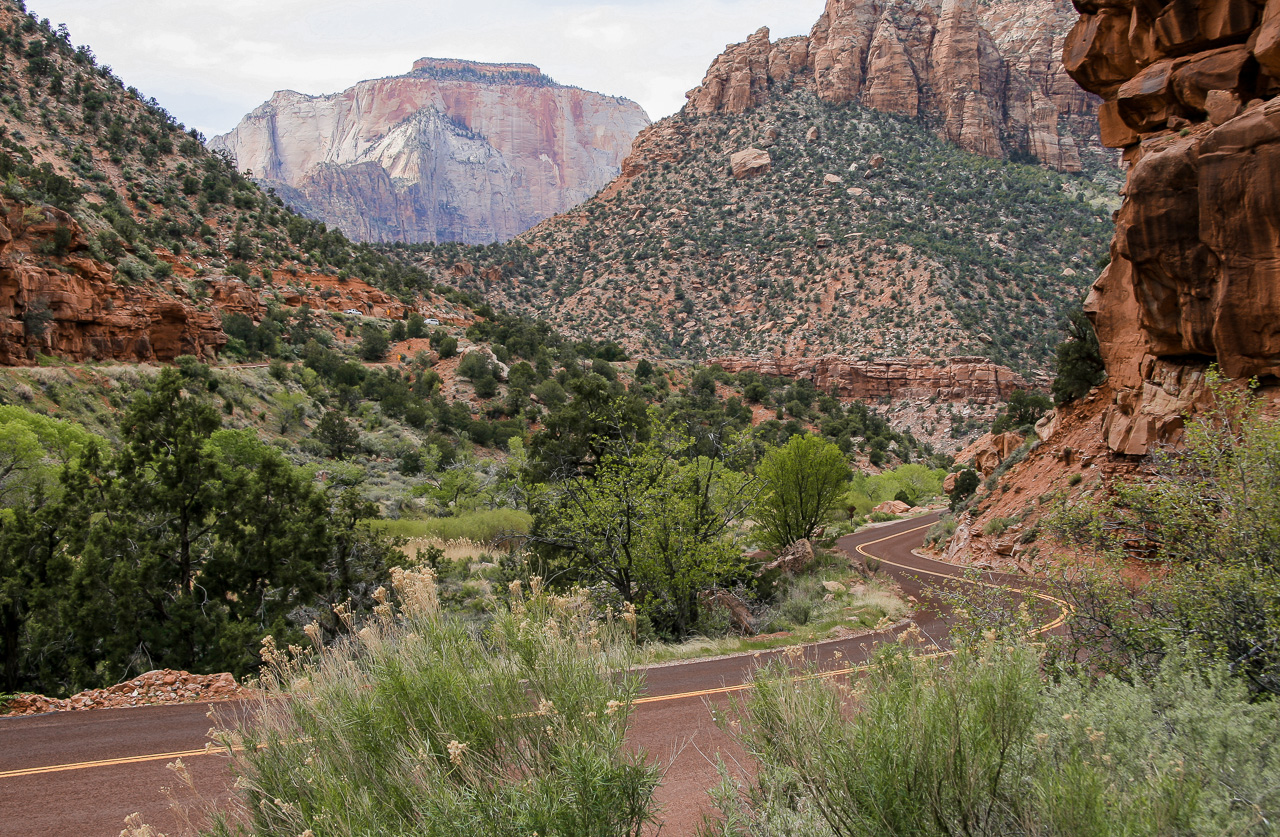
Orange stone cliffs crack and buckle at the seams, smooth and sheer like ancient architecture and dotted with fuzzy green desert shrubs. The asphalt twisting through the park is similarly ginger, and romantically curvy though not the sort on which to get freaky. From Space, State Highway 9 looks like a racetrack, but it’s not worth rushing.
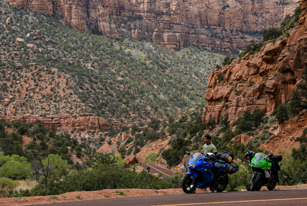
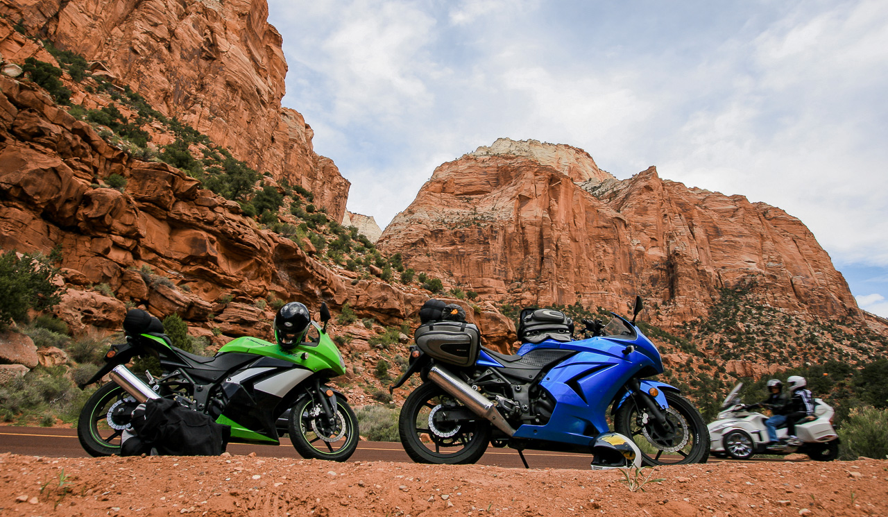
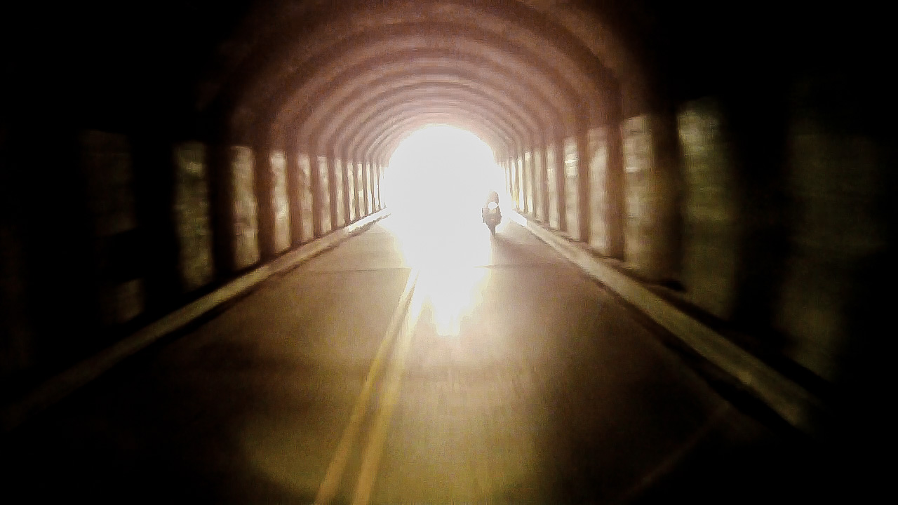
Despite a long stop for photos and gawking from the bottom of Zion Canyon, Brian and I caught up with an RV when a park ranger stopped traffic at a tunnel entrance. Another group of motorcycle travelers pulled up behind us and, after minutes of waiting, suggested we try our luck at skipping ahead of the RV. I waddled alongside the hulking vehicle on idle engine power, expecting the yellow-vested ranger to scold me back in line. “Uh, go ahead.” That wasn’t very stern.
The tunnel digs into the canyon side for over a mile and without electric lighting, just occasional car-sized holes in the northern wall through which blinding natural sunlight pours and disappears in mirrors, replaced with darkness and, in my specific experience, the subtle echoed rumble of five motorcycles gently rolling toward the eastern exit of Zion.
In the absence of distracting rock formations, my eyes spied unhappy clouds in the distance. I pulled to the side of the road and told Brian, “That means rain,” pointing to patches of dark cloud that looked like black metallic dust pulled down to Earth by gravity’s magnetism. I learned to spot distant rain showers whilst touring the Pacific Northwest, but it doesn’t do me much good. Rain or not, we still needed to get to Bryce.
The Wooly Willy rain threats haunted us, but mercifully never materialized more than a quick spritz of water drops. By then, we were more bothered by the dropping temperature.
It was after 5:00 pm when we checked into our hotel at Bryce, but had nearly 20 miles and another thousand feet of elevation before reaching Rainbow Point, what’s essentially the end of Bryce Canyon National Park. It got colder on the way.
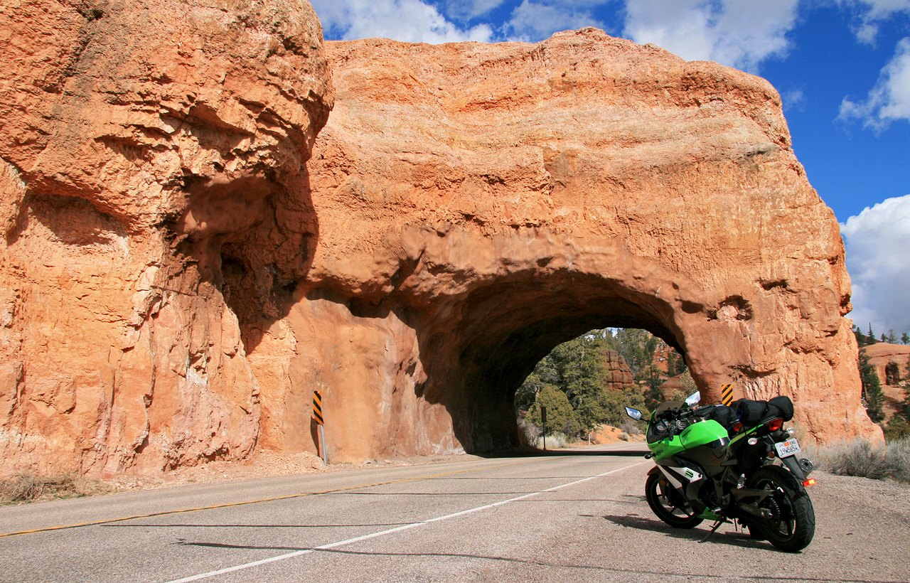
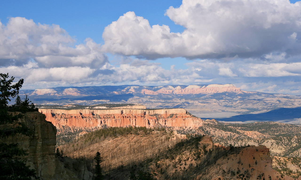
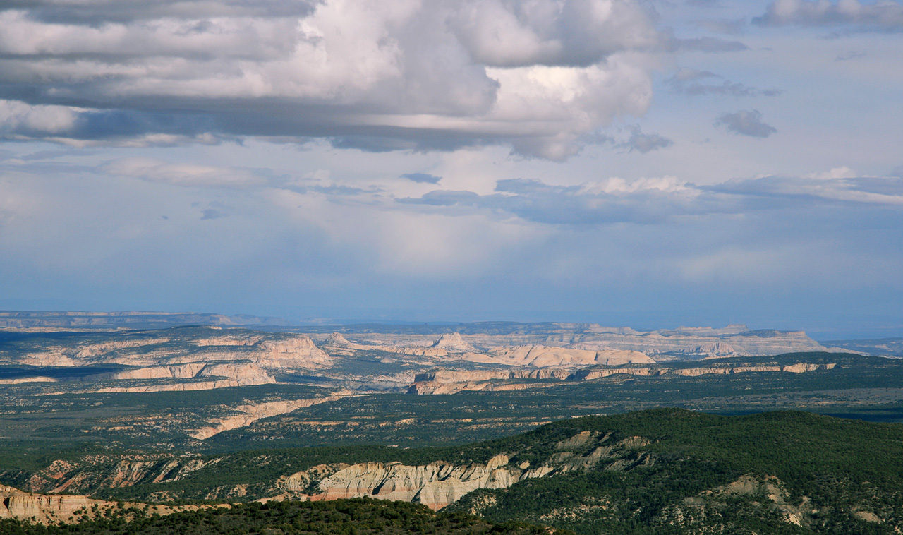
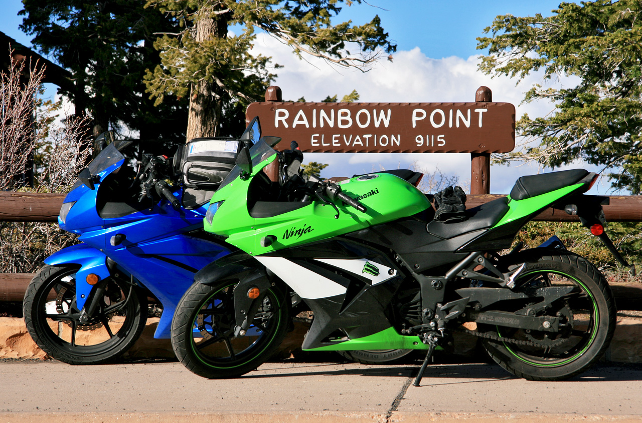
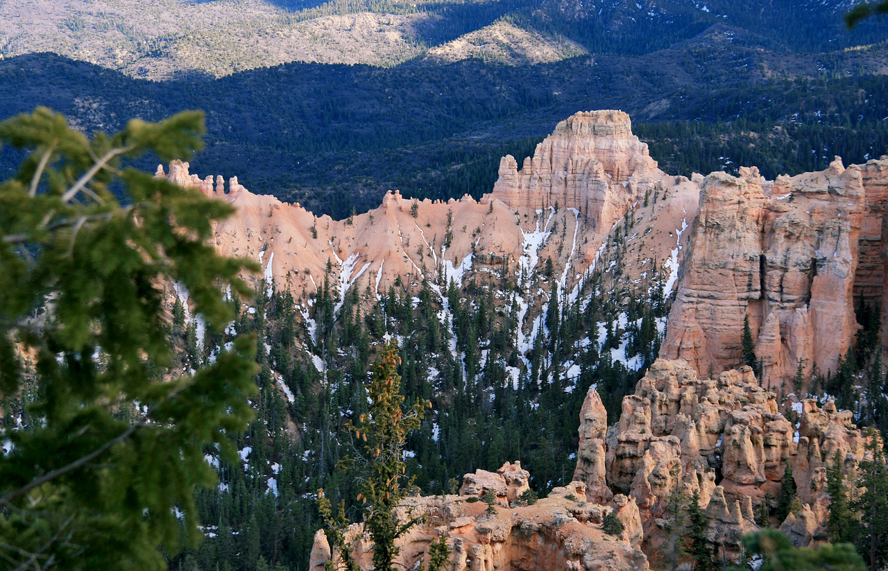
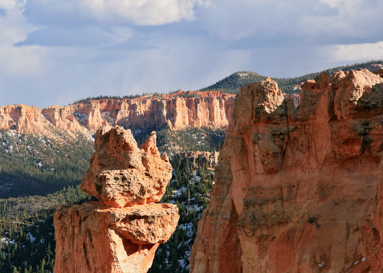
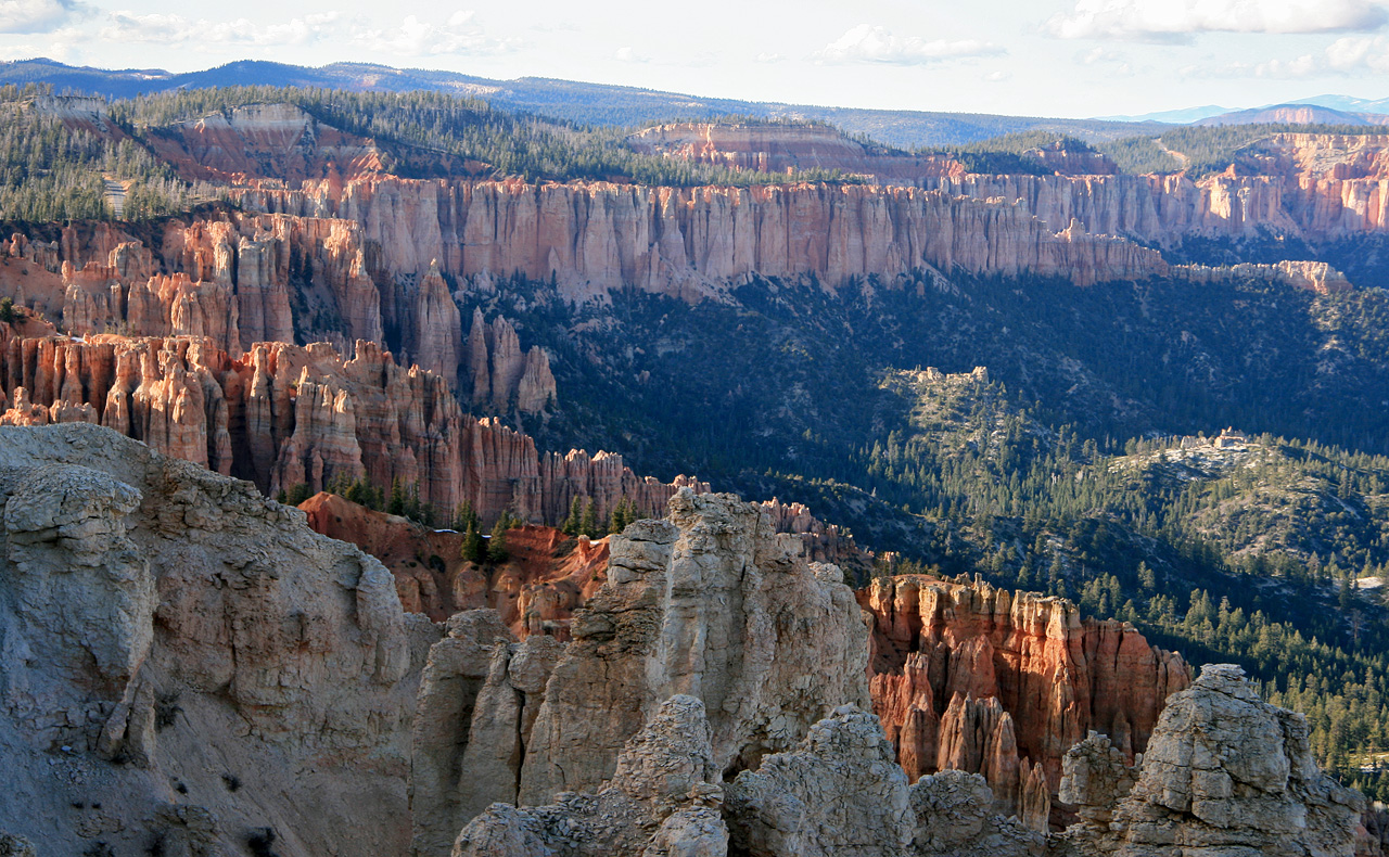
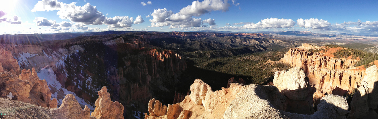
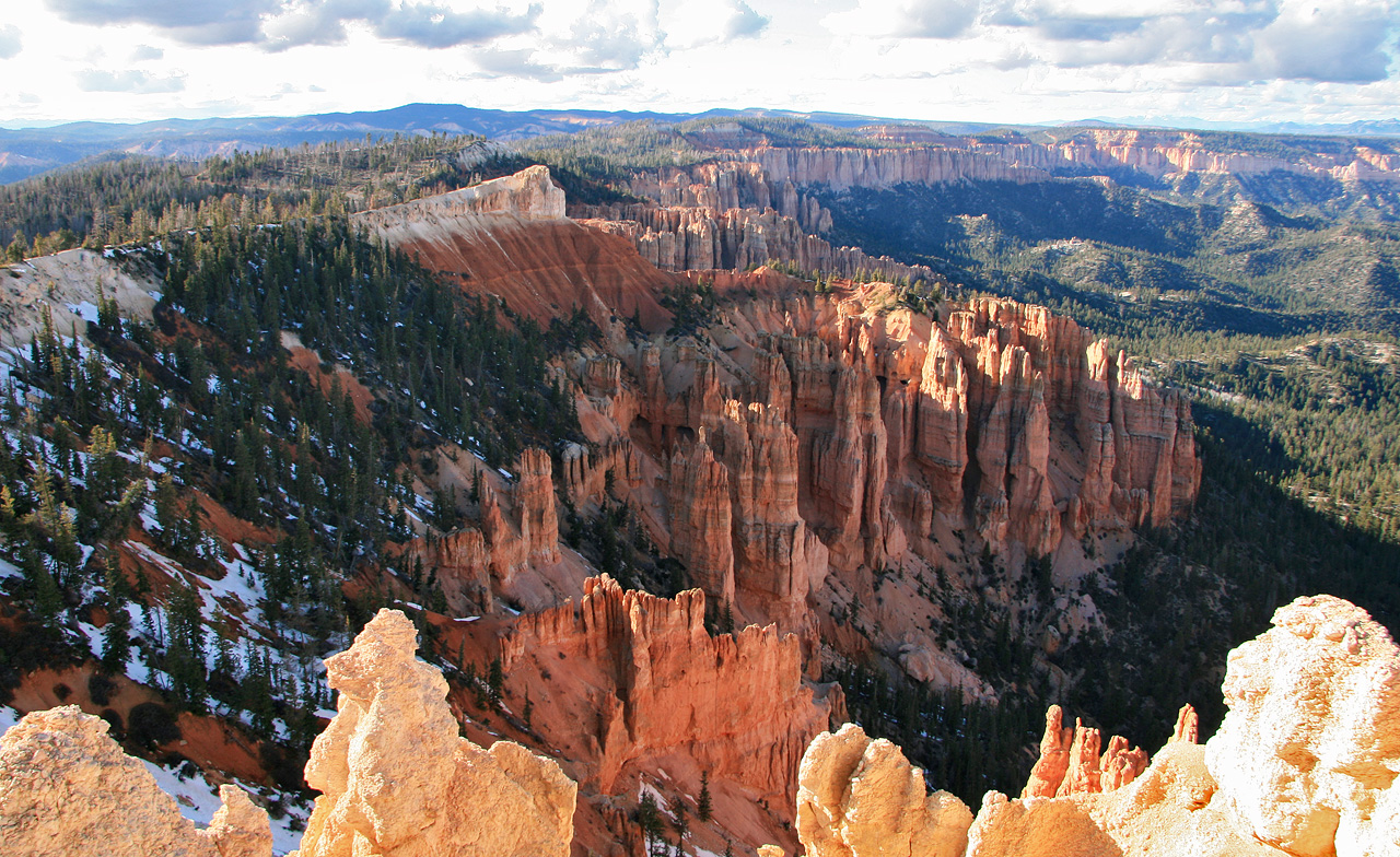
Bryce is accessible by a dead-end highway that goes south to the summit. Along the highway route, large lay-bys open views through dense trees, each view presenting different angles of the alien canyon below. Bony peach-colored points, like bunches of skeleton fingers, line the rim of the canyon and make Bryce uniquely stunning. The state highway ends at Rainbow Point, a crescendo of elevation — 9,115 feet above sea level — and the most impressive panorama in Utah. (In the world?)
The sun was retreating behind trees, Brian and I were freezing and surrounded by snow. We called it a day and rode back down the mountain, clopping over spindly stick shadows cast across the highway by the burnt remains of the lower forest.